
Ethiopia and the River Nile

The Blue Nile's Mighty Historical Journey
After the surprisingly long opposite flow journey of the Blue Nile to the south and towards Ethiopia's Capital, Addis Ababa, the Blue Nile turns northwards, unites with the White Nile in Sudan, and continues to Egypt. Although the Nile is very long and mighty, it can be seen as odd how it is also subdued to considerable water losses and yet remains a legendary mighty river when finally arriving in the Mediterranean Sea. Indeed, due to leaks along its extremely long river path, the River Nile is defeated with many forfeitures of water in soil permeability and evaporation. Furthermore, these countries receiving the water below the Ethiopian Highland are known as warmer lowland areas; nevertheless, this water from Ethiopia finally arrives in Egypt in historical quantities.
Ethiopia and the River Nile
The enlightenment about Ethiopia as the mighty primary source of the river Nile's water and culture is often unknown and met by surprise. Indeed, a rare knowledge is that Ethiopia's high plateau is the abundant water source and the origin of most of the high cultures of history and even the cultural cradle of today's modern civilizations. An insidious guise and policy appear globally, taking its smothering grasp over unfortunate young souls in the advanced nations, with an emotional flagrant ignorance imprinted on the media that even infiltrated the West's most sensitive security departments.
Towards the Mediterranean Sea
With The Legendary Nile River
 |
| Water to the Capital |
This topographical configuration of Entoto Natural Park's mountain crest has the curious result that two raindrops that simultaneously moist the soil of Entoto's mountain crest, only a centimetre apart from each other, will have quite different destinies. After a long journey through the River Nile, one waterway will reach the Mediterranean Sea. In contrast, the other watershed will pass through Addis Ababa, eventually evaporating in the Danakil Desert, as the Awash River never reaches the sea.
The Environment and the Loss of Civilizations
 |
Destructive heritage within many of today's clans of autocrats give the culture a treacherous shift with a legacy of an obscure genetic inflow. |
Directed by this despotism in the past, the political rule of terror created a life-threatening situation against the inhabitants of these original wealthy civilizations. In their despair for their families, very few dared, and few survived in their attempt to undertake any necessary technology or work to promote these water masses to benefit the population during heat and drought. Therefore, this law of silent terror effectively and continuously deteriorated the soil layers' natural strength until this country's ground no longer produced abundant crops. Thus, the lack of basic knowledge and empathy within many early despotic autocracies initiated the decline within these rich cultures of the past, ultimately causing irreversible destruction and erosion of land, often in prolonged and extreme poverty.
Tip of the iceberg:
Cambridge Five spy ring members 'hopeless drunks'
The political failure in the West to guard their most precious departments placed Ethiopia's population and Capital in a dangerous situation regarding solving an unfortunate international graft of treacherously covert political ignorance against Ethiopia's civilization. To carry out a global heritage of rudimentarily infantile behaviour of troublesome quality politics within international issues with their insidiously charming and easy-going emissaries remained an intricate menace to Ethiopia's culture and population. Despite the West's prudent intentions, they failed to understand the danger for themselves and even more the concealed precarious threat by exporting politics with its grafted and malignant plague of charmingly shallow-minded drunks. Therefore, this international menace, with its treacherous threat to Ethiopia, persisted due to the covert power of an insidious international guise, which remained treacherously enticing because of its naive appeal to the youth's infantile perception of humankind's behavioural paradigms. Thus, this urgent threat of insidious irresponsibility from shady emissaries, who duped and fostered sadistic hostility, demanded a solution in Ethiopia, as well as for the populations of other countries that suffered under this menace. Thus, with the treacherous threat from these emissaries' charming social personalities well masking their compulsive but intuitively malevolent intentions against humanity, an urgent solution remained crucial for Ethiopia's people and the country's future and civilization.
The Devastating Consequences of Ideals from Fraudulent Emissaries
Left Irresponsibly and Unattended in the Conquest Of Minds
 |
| This quote by Simon Wiesenthal enlightens the importance of vigilance regarding the nefarious, frugal and dangerous heritage of despotic origin, which tragically grafts a deeply sinister, malign, and deceptive intent to most of its unfortunate population. Health Stimulus and Its Challenges |
Inherited Stimulating Joy: A Risky Journey in Life?
The original culture of humanity, which included intellectual stimulation as a requirement for the young's development, still exists in records of the past but faded away as a prominent practice long ago, leaving the door open for what undermines and defeats reality within the greatness of the World's actual stimulus. Instead, the deceptively secretive and manipulative demands endure as firmly and subconsciously intended to foreclose and even forbid the individual's search for the appropriate intellectual stimulation of their inherited personality—these stimulating emotions, which prevail uniquely for each person and intend to guide them in the days to come. Yet, instead of this evolutionary-based stimulus of the people's intellect, a corrosive subconscious deception of hierarchically idealising ideals endures. Thus, by offering entertaining and glamorous decadence, the insidious lure and trap set in to control the masses. In devastating dominance, this sinister deception's prestige prevails, and in the face of humanity, despite its malicious legacy and shady figure.
A Historical Civilization Under Threat
In this context, Ethiopia had to endure its international silence with its forbidden knowledge as the motherlode of water and the source of splendid ancient cultures. Therefore, for a long time, Ethiopia's population and Capital had to stay forcefully impaired beneath this historic mountain massif that includes a water divider for the Nile's main flow. Thus, Egypt, the ancient high culture, usually regarded as the cultural cradle for the ancient Greek and European civilizations, has its historical culture thanks to the watershed from the Ethiopian Highlands. These past civilizations, located far below and beyond Ethiopia, have nourished their cultural source thanks to this mighty water flow of the Blue Nile and Ethiopia's other major rivers described below.
The History of the Environment
.jpg)
An Ancient Legacy of Water and Plants
The prosperity of civilization in different cultures and parts of the World indicates an evident connection between an in-depth knowledge of biology and the specific culture's potential for development. Without a doubt, a healthy relationship is seen with this rule, even in other sciences. Still, it is particularly evident in biology, as this is so close to human health and well-being. However, the insidious hierarchical governing terror of the past caused severe scares among many nations, inflicting humiliation in severe starvation and fearful aversions, thus damaging the population's most critical needs for safe stimulus in daily life and duties.Ethiopia's Indigenous Vegetation
A Heritage of Tremendous Potential
The native vegetation was, in the past, the natural source of preventing the precious water from draining in short bursts of violent torrents. This seasonal water flow over the Ethiopian Highlands was then historically and even more pre-historically infiltrating the deluges into soil permeability and vertically delivered this mass of purified water to be stored as natural groundwater within ancient aquifers. Hence, the fabric of these original vegetation's roots and soil functioned as countless efficient feeding pipes of deluges directed into Ethiopia's thick soil layers and the country's mountain massifs' aquifers, thus preventing the shortage of groundwater during long periods of drought.
The Importance of Domestic Trees
Reinforcement of Native Roots Against Erosion
 |
| The composite image series above invites a more comprehensive study with explanatory images of the water's flow and ground infiltration. The Torrential Rains and Erosion |
Erosion: The soil-holding capacity of Eucalyptus is very moderate compared with the original Ethiopian ground cover and trees, initially covering the slopes of Entoto. Because there is no ground cover in the foreign-implanted Eucalyptus forest, the only thing to hold the soil is the sporadic web of roots of the trees. This lack of soil stabilizing undergrowth causes severe erosion, which is easily observed in the water running through Addis in connection with the rainy seasons. For every rain period, torrential forces eradicate valuable nutrition while the layer of fertile soil gets thinner. Without due care and preservation within a few years, no fertile ground will remain for new vegetation, and the erosion will be irreversible.
Flooding: On Entoto, every leaf and branch that has fallen to the ground is collected by people, whereas in a natural forest with endemic vegetation, organic material from leaves, wood, roots, etc., is left to be decomposed in the soil. The organic composting matter from endemic vegetation improves the soil structure, leading to a higher infiltration rate and a much better water storage capacity and, of course, provides the fragile saplings with a primary ground for growth. The picture on the right simplifies the connection between land and water, which can be seen by the vertical connection in the study of the infiltrating movements of the water in pictures (5 ) and (7).
[ The Dangerous ]
Implantation of Alien Life Forms
A Massive Loss Of Public Health and Drinking Water
The Environmental Danger Of the Eucalyptus TreeThe Eucalyptus Tree and its Tactical ToxicityA chemical component with an intricate competition-oriented toxic defence system in the leaves and roots of Eucalyptus trees prevents the growth of other trees and herbs. This chemical component leads to a monoculture with Eucalyptus as the only tree species and eventually no ground cover. This chemical component causes severe erosion, easily observed in the water running through Addis, connected with the rainy seasons. Due to these shortcomings in the water-preserving capacity of the Eucalyptus plantation, it cannot counterbalance the uneven distribution of rain.
Domestic Protection and Traditional Defence
The Eucalyptus Tree and its Tactical Toxicity
A chemical component with an intricate competition-oriented toxic defence system in the leaves and roots of Eucalyptus trees prevents the growth of other trees and herbs. This chemical component leads to a monoculture with Eucalyptus as the only tree species and eventually no ground cover. This chemical component causes severe erosion, easily observed in the water running through Addis, connected with the rainy seasons. Due to these shortcomings in the water-preserving capacity of the Eucalyptus plantation, it cannot counterbalance the uneven distribution of rain.
The stalk of the native Podocarpus tree's seed is considerably more significant in height at an early stage of its soil germination than the equivalent tree seeds' stalks. Because the Podocarpus tree has the uniqueness of raising its appetizing greenery to the sensitively exposed height of its brittle stems, a guardian traditionally arises its protective shield thanks to the sharp thorn defence of Rosa abyssinica.
Ethiopia's Water-Harbouring Highland Nature
The Country's Precious Water
 |
| This image forms the basis for understanding nature's water-bearing body. The water is kept here, in the totality of this image, where both vegetation, soil and rock make up this vital body to create this highly valuable water-harbouring landscape. Study of the water's complexity |
Ethiopia's Natural Water Production
Furthermore, history's misdeeds against Ethiopia's natural forests and Nature severely wounded the prehistoric ecological and geological heritage by interrupting the natural and critical processes of the original soil formation derived from endemic decomposing leaves and twigs. This genetically optimized process, resulting from the downfall of indigenous trees in the leaves and twigs of the Ethiopian forest, had the vital ability to hinder the erosive torrents' initiation. This ground composting of leaves and twigs built up the trees' ground and gave the soil's structure the time it needed to absorb deluges in this mountainous highland landscape.
The Natural Water Bodies of the Highland
Ethiopia's Highlands:
The Nile's Trustworthy Water Source
 |
| https://en.wikipedia.org/wiki/AHighlandiver https://en.wikipedia.org/wiki/Baro_River |
The Ethiopian Highland: A Legendary Water Provider
However, this Ethiopian primary source of the Nile River is only one of several Ethiopian rivers that contribute to the total water in the Nile. Consequently, the total amount of water delivered from the Ethiopian Highland to the Nile is clearly above the outstanding contribution of the Blue Nile, albeit wrongly, it is usually described how the countries south of Ethiopia are the source of the Nile.
Explorers Historical Misconceptions
However, this is only correct in the adventure literature and the early travellers' romantic descriptions of heroic adventures and discoveries in the ascent of the breathtakingly beautiful cloud-covered Ruwenzori mountains and glaciers in the mountain range through the countries of Uganda and Congo. The Blue Nile from Ethiopia is here, with 70 - 80% of the Nile's water during the rainy seasons, without comparison to the dominant source of the Nile, which should be essential to point out as a crucial historical reality.
Ethiopia's Water Guardian of the Past
In ancient times, Ethiopia's considerable rainwater resources were probably not so contradictory, and the reason was mainly the abundant natural vegetation of Ethiopia's highlands. This native Ethiopian vegetation served as a highly effective physical barrier, blocking the country's water masses from rushing down the country's slopes in the direction of Egypt. Also, the same native vegetation was why this water was blocking and preventing from draining; thanks to this, the original vegetation functioned as countless very efficient feeding pipes into the mountain massif's aquifers.
The Country's Indigenous Vegetation
Ethiopia's Historical Water Reservoir
 |
| https://en.wikipedia.org/wiki/Pibor_River |
Historically, these large quantities of torrential precipitation become accumulated for a long time within the borders of Ethiopia, with the result that the total water flows in the country were greatly extended over time and, at the same time, subdued in its sudden and erosive overflows. These floodwaters were thus regularly swallowed by Ethiopia's geology, landscape and vegetation during each rainy period.
It is a meteorological phenomenon (Orographic Precipitation) that is very well known and obvious that the incoming clouds transform their moisture into rain as they rise over a high mountain mass. However, this mountain massif does not need to be close to potential civilization to deliver high volumes of water. Still, the source of the precipitation and the beneficial countries may be very distant from one another, such as the Ethiopian Highlands and the Egyptian civilization.
The Adventure of the Blue Nile's Exploration
They hesitated to follow the Blue Nile to such a high degree that the explorers, first in 1968, could muster the challenge and lure of the more significant cause of this ancient and mysterious water flow by following an arduous journey through Ethiopia's deep gorges and canyons. Thus, they gazed at the horizon of Lake Tana, the still mythical source of the Nile. Here, the team of 60 British and Ethiopian servicemen and scientists made the first complete descent and scientific investigation of the Blue Nile.
A Journey Through Dizzying Twilight Canyons
Always hazardous, this journey went into waterways of steep rising clefts, endlessly repeating and with little rest with unforgiving dusky nights. Through the hardship and moist starvation, this journey continued into these irresistible, beautiful, but harshly demanding and dizzying looming twilight gorges. They continued intensely beneath these towering high mountain crests of the Ethiopian Highland and among the waterways of deeply lurking beasts. Yet, within still unmapped territories, they finally found their way within these abysses in this concealed landscape underneath the Ethiopian high plateau. Hence, they created the first investigative research on this mighty waterway beneath Ethiopia's historic Highland.
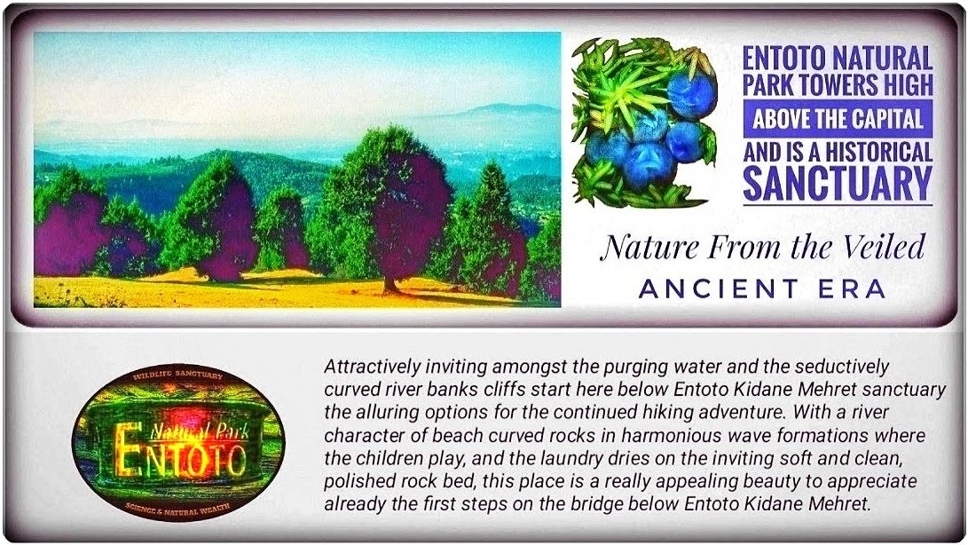
Entoto Natural Park's Enchanting Landscape
 |
| Entoto Natural Park's Southern Rim of the High Plateau. The Viewpoint (16) is pretty near Mountain Crest, A water divider to the Nile. |
The lack of interest in Ethiopia's mighty waterways is widespread worldwide due to political shortcomings and an internationally ignorant media that needs help distinguishing the abundant precipitation source in the Ethiopian Highlands and its subsequent deposition in Egypt and the Mediterranean Sea. Furthermore, a twisted history record emerged due to the early literary legacy of adventurers among explorers and their quest to find the mysterious and elusive source of the White Nile. Erosion Prevention Invitation:
 |
| Landslides and Erosion |
Environmental Restoration
Stabilizing and preventing oversaturation while restoring the
water flow in the Highland landscape is challenging. A Highland
landscape that has lost the significant strength of its original trees'
roots requires careful attention to avoid any hazardous outcomes
along the water's paths on these precarious slopes. Watch videos
Environmental Ideas
from Pinterest:
The Precarious and Fragile Restoration Of the Lost Nature
Science requires significant time and labour for environmental restoration; this demands large-scale protection projects to provide young plants with a replacement for the lost biotope and its vital natural protective properties. Hence, restoring a lost biotope is a highly complex process and requires considerable effort to recreate a reliable substitute for the missing shielding armour of the primordial forest. Therefore, due to the absence of the essential protective functions of mother trees and other plants, enormous efforts are required to recreate these guardian functions for the tender indigenous seedlings, which would otherwise not survive on the very exposed ground. Thus, this process of environmental restoration includes what was previously prehistorically self-evident as a crucial basis for the survival of all higher life forms.
 |
Fasilides Bath, Gondar, Ethiopia. 📸: From Wikimedia Commons. |
A Classic Castle at the Spring Sources
Historical Influences for Restoration
Common check dams offer an opportunity to recreate an environment that is almost ideally suited to people and Nature. For example, placing a building like Fasilides Bath next to a stream on the high plateau would provide Nature with a fantastic water supply. However, in contrast to the water technology of check dams in ordinary, historic buildings, like Fasilides Bath in the picture to the right, would serve as a water contribution to the surrounding landscape, while also enhancing the attraction's capacity as the most beautiful location for facilities. With dramatically classic architecture, this magnificent Castle lodge with a restaurant overlooking the water entices fantasies and dreams in the cosiest, hiking-friendly surroundings. Within the mystique and wilderness of primordial Nature, the Castle offers accommodation with adventure and grace.


Comments
Post a Comment