
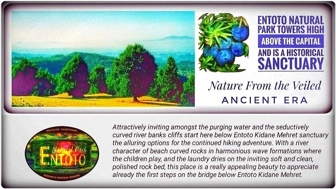
Entoto Natural Park's southern slope

The picture shows a native Podocarpus tree west of the farmhouse (39) - (B)Vernacular names: (Am: Zigba) (Or: Birbirsa)
Practical Hiking Notes from the Park
These hiking notes describe the Park's beautiful, cold morning hours, especially those on the southern slopes and the high plateau. These experiences of this vast and unique nature thus form the basis for future environmental work and for providing materials to help visitors enjoy pleasant weekend trips. 
The picture shows a native Podocarpus tree west of the farmhouse (39) - (B)
Vernacular names: (Am: Zigba) (Or: Birbirsa)
Taxi or Hike from the Capital
The means of transport to reach the Park's large work area at dawn was usually either a regular taxi or a hike from Addis Ababa's centre to the end station in the community of Entoto Kidane Mehret (1). These excursions often continued to the high plateau and further to the nearby highlands of Oromia, well located in Entoto Natural Park (Nursery). The actual mountain hiking started at the Sanctuary of Entoto Kidane Mehret (32) and continued in the wild, mountainous part of the Park.
Seasons for Hiking and Months for Weather Protection
Water: Drinking water must be available year-round, and Caution should be exercised during expected shortages. Since most brooks dry out at some point during the year, it is best to always bring rugged water bottles for hiking. However, a few springs in the Park area provide drinkable water year-round.Rainy Seasons: There are two rainy seasons per year: minor rains from March to May and major rains from July to September. The highest rainfall intensity occurs in July and August (Demissew, 1988).Bath & Swimming: It is significant that the water supply in the high-plateau streams rushes violently during the rainy season and flows pleasantly for a couple of months afterwards. At this time of year, the harmonious flow of water appears as shown in the photos, and the true bath season begins. These afternoons of sun and rock baths last for a few months, in contrast to the hazardous forces of the rainy seasons' violent streams. However, during the highlands' dry months, the lack of water flow in the high-plateau streams makes swimming impossible; the brooks then appear as dry creeks even within the Canyon (B) - (36) - (14), thus offering hiking in a gorgeous landscape.Caution: Rainy Seasons and Climate
Water: Drinking water must be available year-round, and Caution should be exercised during expected shortages. Since most brooks dry out at some point during the year, it is best to always bring rugged water bottles for hiking. However, a few springs in the Park area provide drinkable water year-round.
Rainy Seasons: There are two rainy seasons per year: minor rains from March to May and major rains from July to September. The highest rainfall intensity occurs in July and August (Demissew, 1988).
Bath & Swimming: It is significant that the water supply in the high-plateau streams rushes violently during the rainy season and flows pleasantly for a couple of months afterwards. At this time of year, the harmonious flow of water appears as shown in the photos, and the true bath season begins. These afternoons of sun and rock baths last for a few months, in contrast to the hazardous forces of the rainy seasons' violent streams. However, during the highlands' dry months, the lack of water flow in the high-plateau streams makes swimming impossible; the brooks then appear as dry creeks even within the Canyon (B) - (36) - (14), thus offering hiking in a gorgeous landscape.
Caution: Rainy Seasons and Climate
Towards the Fresh Well-Fragrance Of Highlands
Entoto's threshold rises majestically over the valley [A], where the mountain's southern slope and further mighty hillside invite the first steps of mysterious acquaintance towards this profoundly venerated and historical highland. Here, underneath the Sanctuary (32) within its concealed valley [A] of Entoto Kidane Mehret (1), rise the first steps of the mountain's hillside towards Entoto's high plateau. The multiple paths continue from this valley [A] towards the native mountain Nature, with secret places of pure serenity and often breathtaking views. In majestic veneration, this primaeval precipice, shrouded in a mysterious secret guise from the past, appears to visitors as it towers at a relatively high altitude. Caution is, therefore, an essential foundation for preparation, as the mountain's elevation is quite demanding for visitors accustomed to otherwise healthy activities in the lowlands.
An introduction to Entoto's southern slope
 |
| Bees' Cliff requires Caution in the Canyon, but is assisted by the wide map loop surrounding the gentle and fascinating topography from the points 36, see 14 and 41-42. Assisting Map Routes with Description |
The Path to the Gorgeous River-Dell
The hidden path between the Sanctuary and the gorge runs attractively behind Entoto Kidane Mehret (32) in a concealed curve below its wall. It passes through a small part of the village before the path (5) opens onto a deep ravine and finishes with a downhill towards a traditional bridge. This bridge crossing the sculptural gorge within the valley [A] is also the natural starting point for more dramatic hikes towards the high plateau via the first passing point (37) or (19). With the cosy picnic and water source (19), this Italian-built water technology offers a site very near the Sanctuary of Entoto Kidane Mehret (32) for family exploration.
A Valley for Relaxation and Family Picnics
The highland scenes often appear with the drama of the Canyon's
(B) - (14), nature, and unforgettable dream paths. Well-fragrant and alluring are these paths from Entoto Kidane Mehret's valley [A]; furthermore, the location of the sculptural river-dell and handcrafted bridge is just beneath this Sanctuary (32). Thus delivers the first gentle invitation to the mountain's raised hillside, where its first picnic site is a cosy glade at the Italian ruin fort (38) - (B) at the waterfall.
The Invitation to the trees from the past, Circle (B)
The still, gentle upward hike shown within Circle (B) includes points (35), (38), and (39) and constitutes both crossroads and, with them, somewhat wild paths. This lower circle (B) area also includes a significant but gentle ledge that rises some metres in the hillside and provides a beautiful, charming landscape elevation. To the left of this crossroad is the location for the intriguing underground water ruin-fort (38) - (B), with its captivating view and somewhat dramatic picnic opportunities.
The Canyon and its River give direction in the Circle (B)
Two rugged crossroads appear along the lower section of the map loop (B), just to the right of the Canyon with its river (35), and one in the lower part of the circle (B). The second crossroad is to the right, at the very bottom of the ring. However, these crossroads align with the lower part of the circle (B). The Italian fortification (38) - (B) provides an eastern orientation for both crossroads. Regardless, the choice of their next path will soon determine the continued walk towards higher ground.
CAUTION: Seasons for Hiking and
Months For Weather Protection
 |
Photos: Above, Bees' Cliff (14) with bath and rock- pools, Entoto's Southern Highland Plateau - Early Oct - mid-Nov: Rainy Seasons and Climate |
Water: Drinking water must be available year-round, and Caution should always be a priority. Since most brooks dry out at some point during the year, it is best to bring rugged water bottles. However, a few springs in the Park area provide drinkable water year-round.
Observing: Hiking directly in the depth of the Canyon's (B) - (14) brook bed is only possible if some months have elapsed since the last rainy season. Therefore, walking in the Canyon's thrilling twilight, within its secluded brook cleft, offers an adventure experience unique to those with the courage to surprise a strolling Hyena.
Picnic Provision, Store and Candy
The most necessary for the Park's experience, picnics, and candy shop is located across from the bus stop in the community of Entoto Kidane Mehret (1) or Entoto Maryam (43). Further information about the hiking experiences and their practical circumstances. However, regarding Entoto Park (Z), just below Entoto Maryam (43) is Entoto Park (Z), with many newly inaugurated and completely exceptional facilities, with further possibilities with secluded glamping and wilderness lodging. It's a fashionable, luxurious site that offers a wide range of provisions. Additional information about the hiking experiences and their practical circumstances
A Landscape Of Joy and Unforgettable Memories
Picnics Amidst Trees from the Lost Aeons
 |
Very remote vaguely appears, the Capital and civilization's settlements here from the elevated location on the outer rim of this vast and beautiful high plateau (16). |
Breathtaking Views and Juniper Giants
Mighty in appearance, these Juniperus procera trees seem to emerge from forgotten noble days within a harmonious park-like setting. They stand on the dramatic high plateau's outer rim (16), enchanting visitors with their enigmatic beauty. The landscape invites unforgettable adventures, as these trees still hold the veiled gate to their lofty Sanctuary from a bygone era. Residing on the outer rim of an ancient high plateau and boasting a patinated, pillar-furrowed appearance, they inspire reverence during picnics. Their imposing presence awakens forgotten dreams, evoking a sense of wonder beyond the days of old. With furrowed pillars and green crowns reaching towards the dream's sky, they mark the edge of the high plateau.
A Grandiose Viewpoint with Exciting Adventures
The Resting Place from the Era of Dreams
The high viewpoint (16) is very near here and just a short uphill walk away, above the map loop (B) with its gorgeous meadow and Podocarpus trees (16). With its stunning, mile-wide panoramic view over the landscape, this high site (16) appears charmingly cosy, surrounded by the historical, Podocarpus-related, and ancient Juniper procera trees. To reach this site, just at the outer rim of the high plateau, requires a little detour to the slight right after passing the farmhouse (39) - (B). Arriving at the high viewpoint (16) and the outermost plateau ledge, this seductively blooming fragrance adventure appears, despite the challenges, as entirely captivating. Although this mountain exploration offers a somewhat thrilling experience with a hint of danger, this is because the substantial rise on the mountain's southern hillside provides several wonderful, exciting rests with magnificent scenery. Therefore, this highland route offers an excursion with its typical mountain air, tempting highland air, and enchantingly harsh terrain.
 |
| [CAUTION] - A Mountain of Ordeals | Assisting Map Routes with Description |
[CAUTION] - A Mountain Of Ordeals
The mountain's mighty hillside initiates the first steps of Entoto's threshold and rises majestically over the southern slope. In profound reverence, it appears to any visitor as it towers above a relatively high altitude. Caution is essential for preparation, as the mountain's ascent is quite demanding for visitors with otherwise healthy activity levels from lowland environments. Despite this somewhat harsh highland air, the hiking is captivating and comfortable, but requires regular rest.
The Fresh Well-Fragrance Of Highland
It is essential to drink regularly from a rugged water bottle that meets safety standards. However, beneath Entoto Kidane Mehret's valley [A] and just after the handcrafted bridge, the mountain's slope rises towards Entoto's high plateau, leading to secret places of pure serenity that often offer breathtaking views. However, it's a Highland with demanding conditions, so even sporty tourists must use their stamina carefully.
Mountain Hiking Preparations
Despite this somewhat harsh highland air, the hiking is captivating and comfortable but requires regular rest. Of course, drinking regularly from the brought-with and rugged water bottle is also essential. Restaurants and amenities at Entoto Kidane Mehret Sanctuary (32) and community (1).
- 1. This area's ancient legends and reverence for its description thus call for the responsibility of reproducing a comprehensive, reliable, and inspiring creative image of the Park's character.
- 2. These vast experiences of a captivating nature, landscape and the area's golden majesty, although often mysteriously veiled in a guise, formed the basis of the alluring and irresistible motivation that made every severe step with the Park's work an inspiring but usually demanding task.
- 3. Through the mountain's unique and legendary past and the dramatically beautiful and gracious nature, a physical and visual stimulus was given that inspired and created pure and deep joy for other ever-extensive mountain walks.
 |
- 4. These mountain walks were often made from the Addis Ababa city centre early in the morning and well before any dawn light, usually about 6 - 6:30 a.m., with the regular taxi to the station of Entoto Kidane Mehret (1).
- 5. Since these very early mornings were near frigid cold and, besides, the highland air somewhat demanding, this weather situation meant that the choice of clothing was characterized by what is otherwise usually used in northern latitudes or alpine areas.
- 6. Solid backpacks were also large enough to store warm clothes and rugged water bottles when daytime temperatures usually rose to about 20 ° Celsius, making the winter clothes too warm.
- 7. These very early mornings of long and chilly hiking offered nature and wildlife experiences that would not have been possible if a later hour had been chosen. Furthermore, early mornings allowed a return to the Capital around lunchtime.
- 8. This return to the Capital was made by taxi or bus from either the station at Entoto Kidane Mehret (1), with its picturesque town and beautiful Sanctuary, or by taxi from Entoto Maryam (43), located on the high plateau.
- 9. This return journey at lunch hours constituted well-being and magnetic stimulation for the continued days with mountain experiences. The choice of more extended hiking would have very demanding and purely exhausting effects in this often rather steep highland and harsh high-altitude air conditions.
CAUTION: Highland Conditions
 |
| Alerts: Safety and Security |
Note that the mountain massif is vast and has highly dramatic terrain. Hence, the family on an excursion should avoid tiring adventure tours that go too far into the enchantment in the mountain and beyond the heart's stamina. This cautious observance in the family's daily routine concerns the family's well-being and pleasure in the Canyon, the vast high plateau. This Caution is crucial because the beauty and ordeals of each place are just at the upper limits for a pleasurable excursion. **Therefore, Do Not Combine the family's today's new mountain adventure with tiring and exhausting fluttering trips between Entoto Kidane Mehret (1) and Entoto Park (Z), including Entoto Maryam (43), on the same day.
Entoto Kidane Mehret's Sanctuary and Secluded Town
Entoto Kidane Mehret (1) is a quaint town on a secluded mountain ledge, yet in pleasant contact with the Capital. The Capital and the Park are closely integrated, yet, surprisingly, the mountain nature often remains mysterious, wild, and concealed by the topography. Thus, the concealed mountain village and Sanctuary (32) of Entoto Kidane Mehret invite contact with the grandeur of ancient history and the highlands. Furthermore, this Sanctuary of Entoto Kidane Mehret serves as an introduction to the mountain's nature. Even the high plateau of the Park is intriguingly near yet in an untouched, towering magnificence. The valley [A] and its seductive, polished rock-gully allure are just beneath the Sanctuary and are thus appropriate to consider an integrated part of each other's nature.
 |
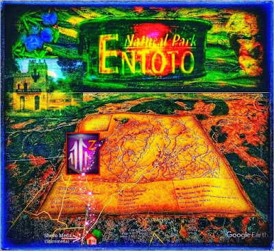
| This map description forms the mountain's southern slope and from point (16), even the threshold to the massif of Entoto's high plateau rising shoulder. Detailed Map and Route Descriptions |
The Sanctuary of Entoto Kidane Mehret (32) offers the first impression of a highly elevated, original mountain landscape and its overwhelming grandeur. A traditional and handcrafted bridge within the map square [A] constitutes a central part of the valley, and the river crosses just below the Sanctuary of Entoto Kidane Mehret (32). With this, the first careful invitation to a flavour of wilderness is given, but with a mysterious feeling of an unknown grandeur, still only waiting to be revealed.
[A] Entoto Kidane Mehret's valley and its paths
Here are the experiences of the ravine and the river, their fascinating formations in overwhelming contact. Within this open valley [A] are pathways and bridge crossing locations. This enticingly cosy valley and its inspiring gully attract while waiting in pleasure. Thus, stay for a while and do not risk losing its beauty, but remain spiritually in harmony and fully absorb its beauty of sculptural shape and its feeling of just waiting for premonition adventures.
Mountain Maps & Alerts with Assistance
of Path Directions [A] - (B) - (14)

The superficial water-conducting metal pipe (37)—[A] assists the mountain hike, and its apparent suitability begins on the slope above the valley [A]. This place is easily reached from below the valley [A] with comfortable passing between a couple of cottages before it continues and reaches a gentle high level on the mountain's shoulder.
Warnings about Robbery and Assault when TravellingWarnings about threats and robberies when travelling abroad should be common knowledge. The most recent information on security risks in the Addis Ababa area should be a clear precaution, but handled with a gentle touch. This, while the dangers in and around Addis Ababa may seem minor compared to the risks of assault in the USA, where the real threats of personal distress from assault are more common and significant. This threat is especially true when visiting major cities in North America, yet it is important to remain vigilant, even in Ethiopia's gentler, more compassionate culture.

Caution is here an essential foundation because themountain's rise is quite demanding, even so, forvisitors with healthy activities from the lowlands.
CAUTION: Use the Camera withExtreme Caution in Contact with Precipices.
CAUTION: Dramatic Distances and High AltitudesBesides, Entoto Kidane Meret Sanctuary (32), with its Church and Monastery, is astonishingly hidden, tucked into the rising shoulder of the mountain massif. A dizzying perception arises very soon and demands care for young families. This observation is evident because dramatic views display spectacularly beautiful landscapes featuring gorges, precipices, and gullies.
Demanded Harness in Contact with Abyss While these unique impressions can be thrilling, they also present a somewhat hazardous situation. It's crucial to handle your camera with care and avoid the abyss. Remember, your safety is paramount, especially when you venture away from the comfort of Entoto Kidane Mehret (1) mountain town and Sanctuary (32).
Suggested activities, amusements, and entertainments options and lodging arrangements:
 |
Caution is here an essential foundation because the mountain's rise is quite demanding, even so, for visitors with healthy activities from the lowlands. |
CAUTION: Use the Camera with
Extreme Caution in Contact with Precipices.
CAUTION: Dramatic Distances and High Altitudes
Besides, Entoto Kidane Meret Sanctuary (32), with its Church and Monastery, is astonishingly hidden, tucked into the rising shoulder of the mountain massif. A dizzying perception arises very soon and demands care for young families. This observation is evident because dramatic views display spectacularly beautiful landscapes featuring gorges, precipices, and gullies.
Demanded Harness in Contact with Abyss
While these unique impressions can be thrilling, they also present a somewhat hazardous situation. It's crucial to handle your camera with care and avoid the abyss. Remember, your safety is paramount, especially when you venture away from the comfort of Entoto Kidane Mehret (1) mountain town and Sanctuary (32).
Suggested activities, amusements, and entertainments
options and lodging arrangements:

Comments
Post a Comment